P.O Box 01, Uganda | Tel: +256-772-460408 | E-mail: [email protected]
Location & Size
Location and size
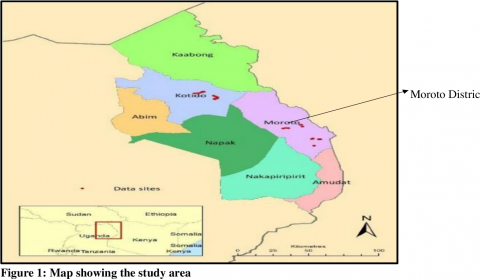
Moroto district is situated in the Mid North Eastern Uganda covering at an altitude of 1,356m – 1,524m above sea level. It lies between Latitudes (including Napak): 1o53’; 3o05’ North and Longitudes: 33038’; 34056’ East and shares boarders with 5 districts namely: Kaabong in the North, Kotido in the North East, Napak in the West, Nakapiripirit in the North West, and Amudat in the South. The entire Eastern borderline is shared with the Republic of Kenya. Moroto District headquarters are situated at Plot … Independence Avenue in Moroto Municipality, and the district has a total area of 3,537.7KM2 of which land area is 3,500 KM2
. Historical Background
Moroto was part of what was formerly called Karamoja province, which was later split in 1971 with the creation of Moroto District. In July 2001, there was further split with the creation of Nakapiripirit District. Again last FY 2010/11 Napak district was created from Moroto District.
The Settlement pattern in the district is of a scanty nature with concentrations around productive agricultural areas, trading centres and near rivers and springs. Due to security reasons previously, people live in clusters called “Ere”. A typical “Ere” has both an outer and inner subdivision fence of thorns, with animal shelders usually in the centre of the homesteads.
The district has well-established traditional Institutions that could form an entry point for social mobilization and community action for transformation of society, all that is needed is to mobilize and sensitize the Institutional Leaders on their role as complementary change agents in addition to facilitating their activities in this direction.
Map of Moroto District